Satellite Imagery
Advertisement

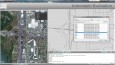
Automapki v.1.3.3
Automapki application brings web mapping and public satellite imagery to AutoCAD / ZWCAD / Bricscad software to display your project on top of your favourite web mapping source: Bing Maps, Google Maps, Yahoo Maps or Open Street Map.
Advertisement
Automapki x64 v.1.3.3
Automapki application brings web mapping and commonly available satellite imagery to AutoCAD / ZWCAD / Bricscad software to display your project on top of your favourite web mapping source: Bing Maps, Google Maps, Yahoo Maps or Open Street Map.
Geographic Imager v.3 1
Working with raster imagery doesn't have to be complicated. Geographic Imager® enhances Adobe Photoshop to make working with spatial imagery quick and efficient.
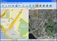
Map View
Map View is a professional map browser. Both satellite imagery and maps online can be viewed through it. With the cache technology, it improve the user experience of viewing map. And more, the map can be viewed even when the computer is offline. It's a
Map Export v.2.7.1.0
Map Export is a GIS developer oriented tool for downloading and exporting background image. Map Export can export both satellite imagery and street maps from Google Map. It can export in many kinds of bmp format as you like.
Encom PA v.10.0.18
With Encom PA, you can see and compare all your line data, profiles, grids, modelling, images, drilllholes, maps and 3D visualisations in a single interactive interpretation environment.
Moagu v.2.0
Put Real USGS Topographic Maps, Aerial/Satellite Imagery, Scanned Maps And More On Garmin Handheld GPS Units!
MapToaster Topo/NZ v.4.0.194
MapToaster Topo New Zealand is New Zealand's only topographical mapping suite, with options for your computer and Garmin GPS, including: - all the rich detail of the LINZ topo maps - seamless across NZ. Now includes Topo50 and Topo250 map series.
Catfood Desktate v.2.22.0003
Catfood Desktate is an eye catching earth simulator that combines satellite imagery, near real time cloud data and optional layers including political borders and place names.
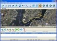
OMapView v.2.7.1.0
OMapView is a professional online map browser. Both satellite imagery and maps online can be viewed through it. With the cache technology, it improve the user experience of viewing map. And more,
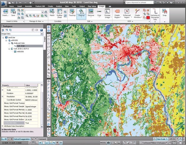
AutoCAD Raster Design v.2013
Get More Value from Your Raster Imagery Make the most of raster images, maps, aerial photos, satellite imagery, and digital elevation models.